Пользователи, которые хотят получить знак // 0 участ.
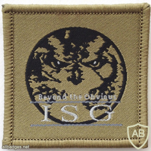
Singapore Army Imagery Support Group Patch
The Imagery Support Group (ISG) was established in 2000. It develops and operates the Singapore Armed Forces' (SAF) imagery and geospatial capabilities. ISG started with a small and diverse community of mappers and imagery analysts. Today, ISG has grown into a professional and operationally ready formation.
One of the key roles played by ISG includes supporting the SAF in the conduct of Humanitarian Aid and Disaster Relief (HADR) operations and Peace Support Operations (PSO). ISG does this through the provision of relevant imagery reports and maps, as well as imagery and geospatial analysis support.
ISG was presented with regimental colours in 2007 and the formation headquarters consist of several branches including Plans, Operations, Logistics, and Administration.
Logo and Motto
ISG's motto "Beyond the Obvious" encapsulates ISG's commitment to establish new frontiers in imaging technology, analysis and skill sets. It also represents its dedication to forming new standards and reaching new heights.
Units under ISG
SAF Mapping Unit
The SAF Mapping Unit was established in 1970 to produce topographic maps for the SAF. Today, it is the only professional mapping organisation in Singapore, providing MINDEF/SAF and other government agencies with geospatial products and services in support of their training, mission planning and execution. It is principally structured to perform two specific functions, namely professional mapping and promulgation of Geographic Information System (GIS) data.
SAF MU is able to develop realistic three-dimensional (3D) virtual maps with accuracy and efficiency. It produces not just standard maps but also precise geospatial products that are akin to those provided by location-based services.
The data of the 3D maps provides the foundation of precise map coordinates in various command and control systems, and is mainly used for planning and analysis, as well as an aid for navigation. In addition, troops use these maps as part of their battle procedures to understand the latest terrain conditions, as well as carry out risk evaluations of the area. Details such as the height of the terrain, building and vegetation as well as optical devices and weapon types, are all taken into consideration when performing line of sight analysis, which can help to increase the situational awareness of security forces, enabling them to monitor suspected threats more effectively.
Imagery Analysis Centre
The Imagery Analysis Centre (IAC) was formed in 2003 to bring together the imagery analysis capabilities of the SAF into one place. IAC analyses commercial satellite imagery in support of training, peace support operations and humanitarian aid operations.
Open Source Centre
The Open Source Centre (OSC) was established to support the SAF by monitoring news and information relating to global military and security developments and natural disasters occurring in the region. The centre focuses its research efforts mainly on open source print, television and online news.

